Looking for a bike lane map is no longer just a matter of curiosity; for many people, it can make the difference between riding with confidence and leaving their bicycle at home. In a city as dynamic as Mexico City, identifying a bike lane, cycling corridor, or safe connection helps cyclists plan practical routes instead of navigating unpredictable streets filled with vehicle traffic and complex intersections.
The cycling network reached this point after years of steady development. Before 2026, Mexico City already reported more than 344 miles of bike lanes, with an additional 143 miles included in the active cycling infrastructure plan and a goal of adding 186 more miles during the course of the administration. Therefore, the network’s expansion was not the result of a single event but rather the continuation of a long-term strategy to improve urban mobility.
What Does a Bike Lane Map Show?
A bike lane map helps cyclists identify routes, network connections, and areas equipped with cycling infrastructure. Specifically, it shows which streets and avenues feature dedicated bike lanes, where protected cycle tracks are located, and which sections provide physical separation from vehicle traffic. In addition, it highlights key connections that make cycling safer and more convenient for daily travel.
A bike lane map also helps explain why some cycling routes attract more riders than others. At first glance, an isolated bike lane may appear to have limited value. However, when viewed within an accurate and up-to-date map, cyclists can see whether it connects to major corridors, intersects with other cycling routes, or forms part of a larger transportation network.
How Many Bike Lanes Are There in Mexico City?
The most common question is a simple one: How many bike lanes are there in Mexico City? According to data available before the current expansion phase, the city had already developed 344 miles of cycling infrastructure over approximately fifteen years. Therefore, this figure provides valuable insight into the scale and maturity of the network rather than simply counting individual routes.
Still, the total mileage tells only part of the story. Different cycling facilities provide different levels of comfort, safety, and separation from vehicle traffic. The network includes protected bike lanes, bike routes, shared lanes, cycle tracks, and integrated mobility corridors designed to support seamless urban travel. As a result, using a Mexico City cycling map can help distinguish fully connected corridors from fragmented sections. Moreover, this insight highlights the importance of high-quality lane delineation and roadway safety products that enhance protection and improve the overall cycling experience.
How the Gran Tenochtitlán Bike Corridor Changed Mexico City’s Cycling Map
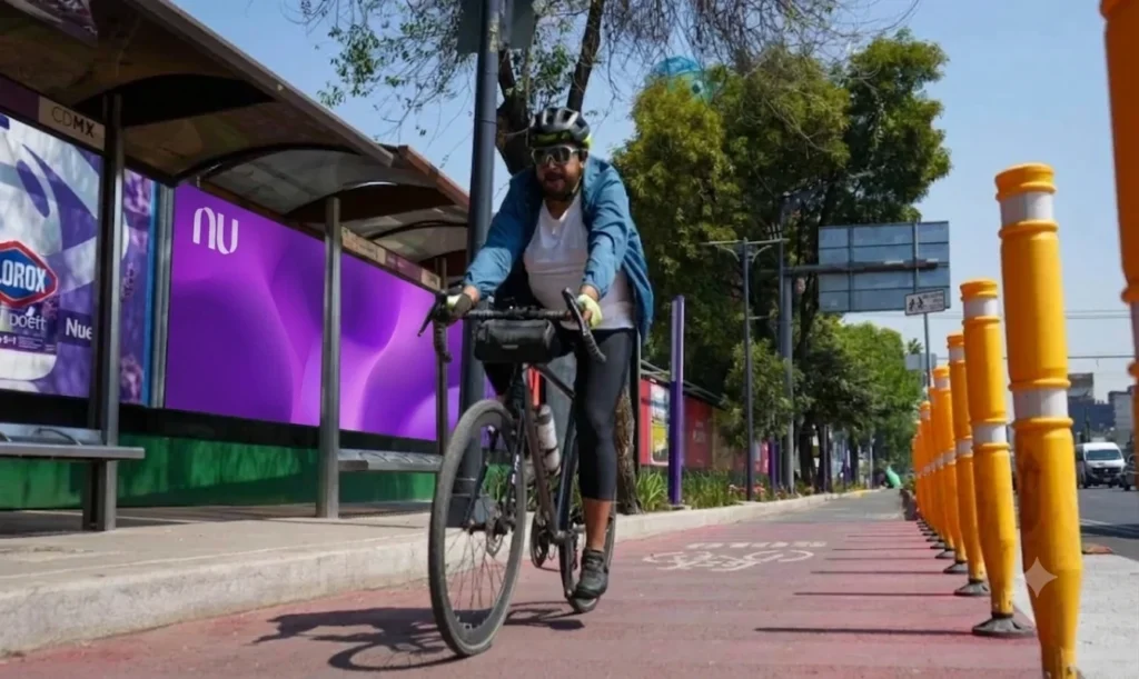
In April 2026, the Gran Tenochtitlán Bike Corridor was inaugurated along Calzada de Tlalpan, becoming one of the country’s most important cycling infrastructure projects due to its scale. Official sources describe it as a 21-mile corridor and a key component of the transformation of Tlalpan into Mexico City’s first multimodal avenue.
The project’s importance goes beyond its length. The project includes new sidewalks, curbs, roadway delineation, 338 bike lane separators, 5,299 traffic delineators, road signage, reboundable delineator posts, road studs, precast concrete barriers, and more than 5,000 streetlights. Together, these improvements transform the bike lane into a multimodal corridor where cyclists, pedestrians, public transportation users, and motorists can coexist under clearer and safer traffic regulations.
A Bike Lane Map for Better City Mobility
Most users turn to a bike lane map for one simple reason: to find the safest and most convenient way to travel. In this regard, the map should do more than display cycling infrastructure—it should help riders select routes according to their origin, destination, schedule, and cycling needs. Moreover, the ideal route for a leisure ride may be very different from the one used for a daily commute. As a result, clear route information supports safer, more efficient, and more comfortable urban cycling.
For this reason, it is important to evaluate the continuity of a cycling route before starting a trip. A bike lane may begin as a protected facility but lose separation at key intersections, while a slightly longer route may provide better access to a cycle track or a bike-sharing station. Therefore, cyclists should look beyond distance alone when planning their journeys. In many cases, the best route is not the shortest one, but the one that offers a clearer, safer, and more consistent riding experience.
Where Bicycle Infrastructure Is Expanding
Mexico City’s cycling network has expanded primarily in districts with significant transportation demand, such as Coyoacán, Benito Juárez, Iztapalapa, Cuauhtémoc, and Miguel Hidalgo boroughs. Furthermore, key bicycle corridors now run alongside major thoroughfares including Calzada de Tlalpan, Eje 4 Sur, and Eje 8 Sur. As a result, more residents can travel between residential areas, workplaces, and mass transit stations through a safer and better-connected cycling infrastructure.
Cycling infrastructure growth delivers its greatest impact when it is approached as part of a broader network rather than a standalone project. A new bike lane can enhance a specific section of the city; nevertheless, a connected system improves the entire journey from start to finish. For this reason, a cycling network map helps reveal what may go unnoticed at street level: routes are becoming increasingly interconnected, creating a safer and more efficient experience for cyclists.

Ecobici and Everyday Cycling
The cycling network becomes even easier to understand when viewed alongside Ecobici, Mexico City’s public bike-share system. Before 2026, the system reported 689 docking stations and 9,300 bicycles. Across the city, an estimated 456,892 bicycle trips were made on a typical day, representing a 71% increase compared to 2018.
That trend shows that the map serves more than just people who own a bicycle. It also helps users who combine public bike-sharing, the Metro, walking, and cycling infrastructure as part of their everyday journeys.
How To Use the Mexico City Bike Lane Map
When using a cycling network map in Mexico City, begin by locating both your origin and your final destination. Next, analyze whether the route is fully continuous or if it requires connecting different infrastructure types such as dedicated bike lanes, shared lanes, and low-traffic streets. Moreover, for beginners, it is best to choose corridors that offer physical separation from vehicles, strong lighting conditions, and highly visible intersections. As a result, you significantly improve safety, confidence, and overall trip efficiency.

A network that is now available for consultation
The real value of a bike lane map is its ability to transform complex urban data into clear, practical decisions. For instance, it allows users to see where to cycle, how to bypass less comfortable sections, and which zones are already integrated into an expanding cycling network. At the same time, this reinforces the idea that Mexico City is not starting from scratch, but instead building on existing kilometers, accumulated experience, and continuously expanding bike corridors.
The Gran Tenochtitlán Bike Lane introduces a landmark element that the bike lane map can no longer overlook. Meanwhile, Calzada de Tlalpan has shifted from a roadway dominated by motor vehicles to a more integrated multimodal corridor. Therefore, for users seeking better mobility, the key question is no longer if cycling routes are available, but which one makes the most sense to use today.